
Improve Connectivity with New Paths, Trails, & Bridges Between the Campuses & Downtown
It is currently not feasible to walk or bike the length of the river from Argo to the Arb. Build new pedestrian crossings over the river, a mix between bridges and underpasses, to improve connectivity between downtown, Central, North, and Medical Campus. Restore old trails and pathways and build new ones to improve access to parkland and the river for residents, students, staff, and visitors.
Recent Improvements
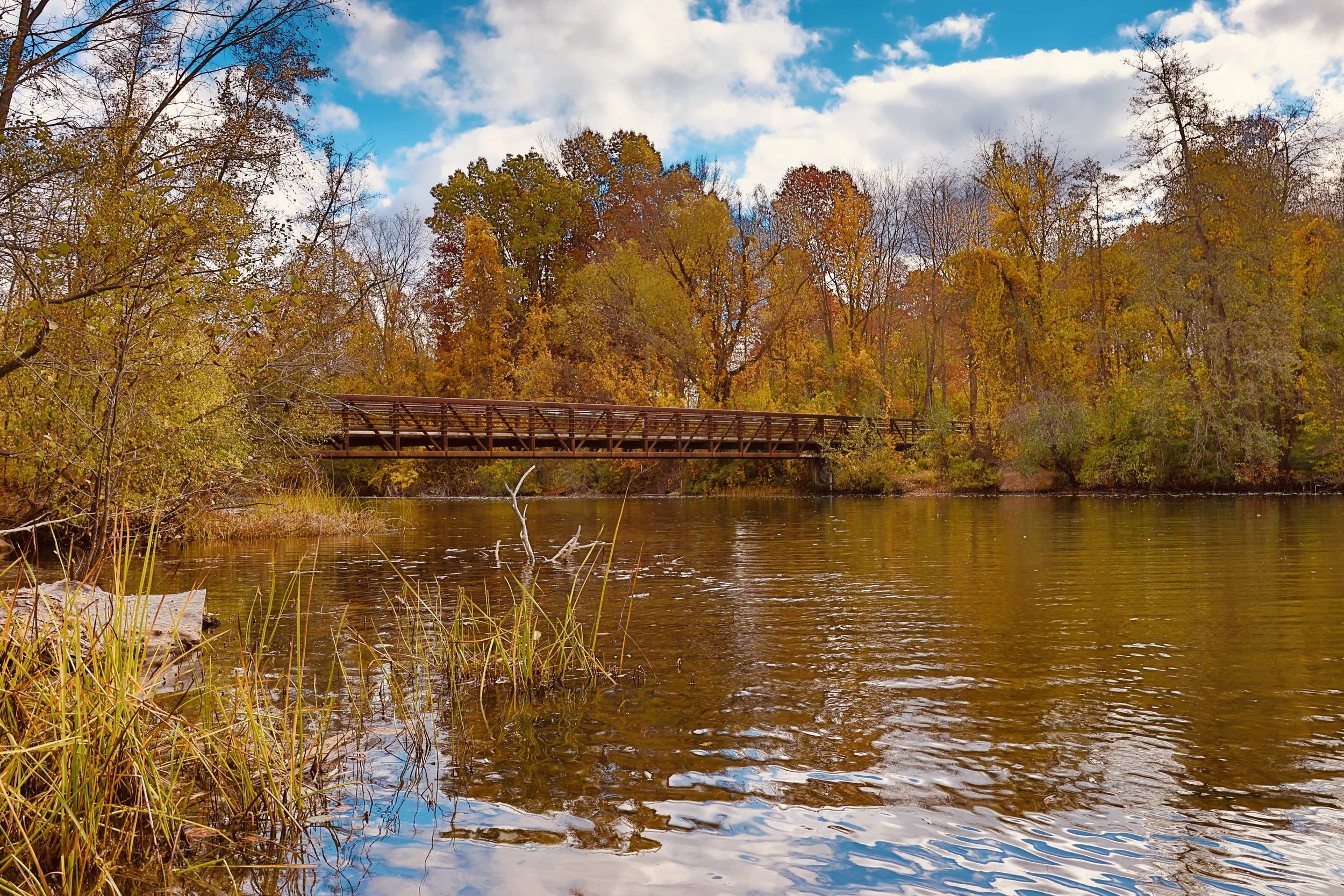
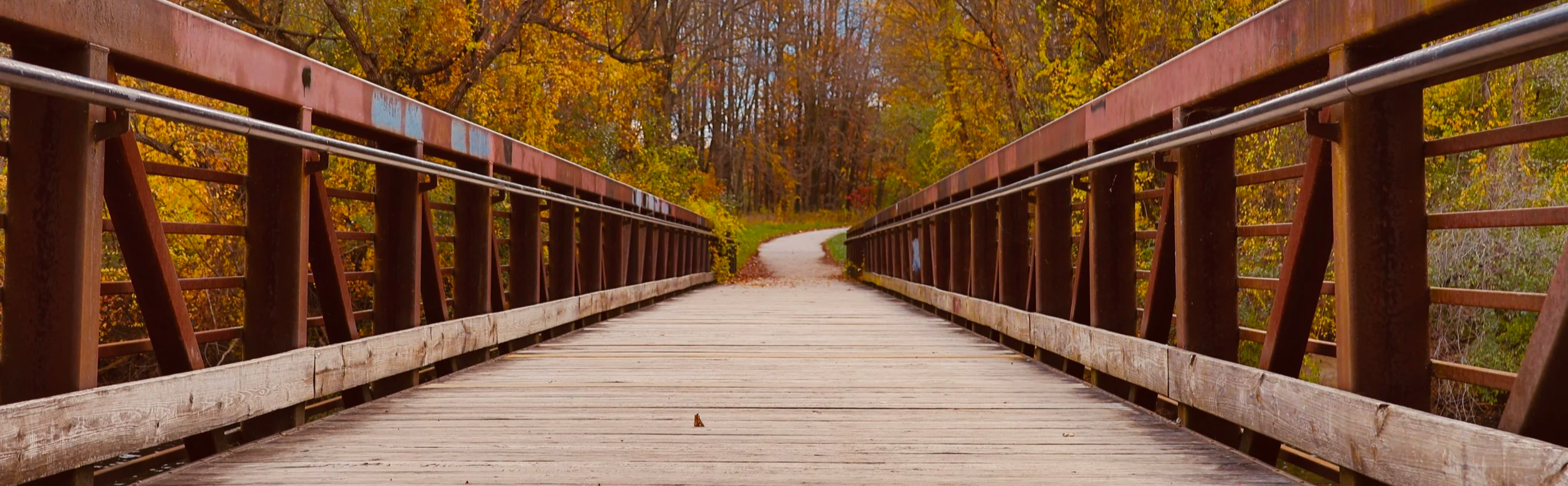
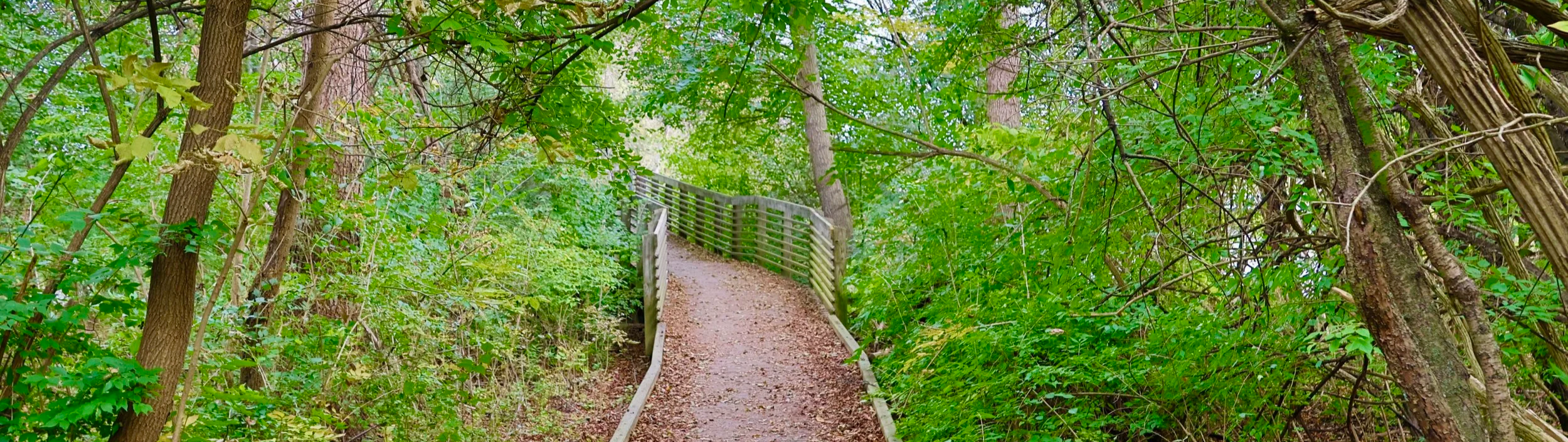
Barton Nature Area Paved Trail
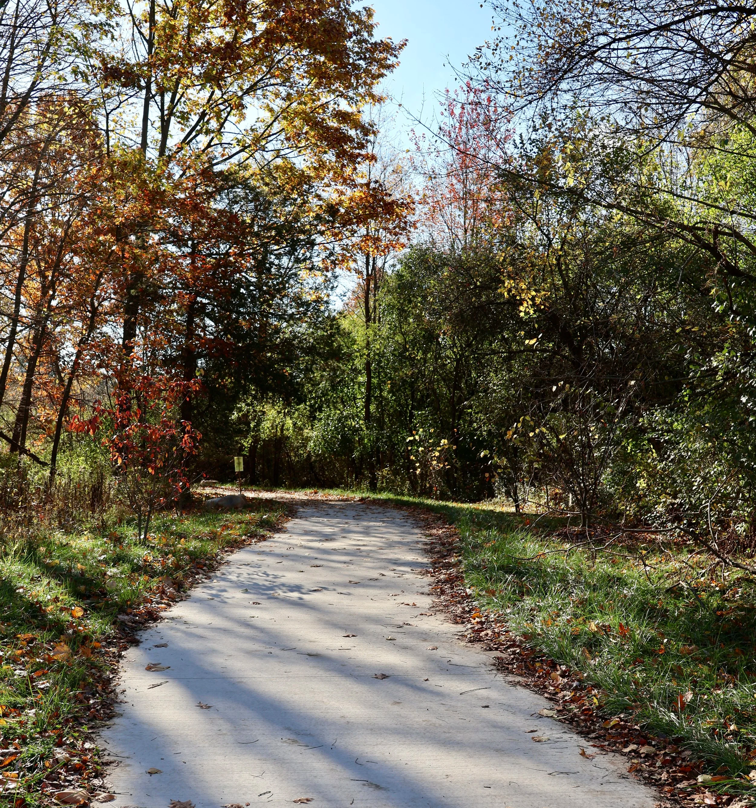
A 0.6-mile paved path through Barton Nature Area was completed in August 2024. The path connects across a pedestrian bridge off of West Huron Drive through a wooded area before reaching another bridge at Barton Dam. This project, which includes a new playscape for children and an upgraded canoe launch, provides accessibility for everyone to enjoy a day in nature.
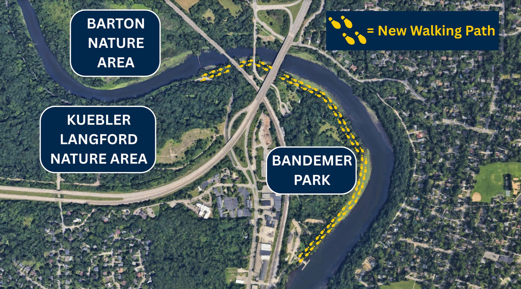
Barton-Bandemer Pedestrian Tunnel
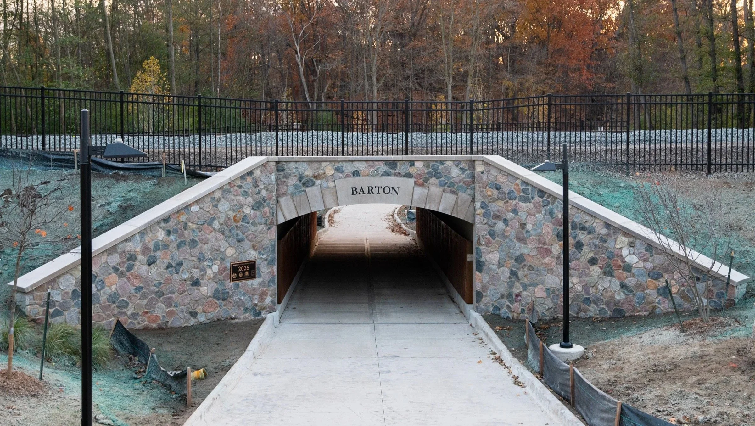
Opened to the public on November 5, 2025, the new Barton-Bandemer Pedestrian Tunnel connects the Barton Nature Area and Bandemer Park on the Border-to-Border Trail. The tunnel goes below the railroad tracks, removing a major barrier for walkers and bikers to navigate between the two popular parks. This is a major step in creating a fully connected network of trails from Barton to Gallup.
Broadway Park West Footbridge
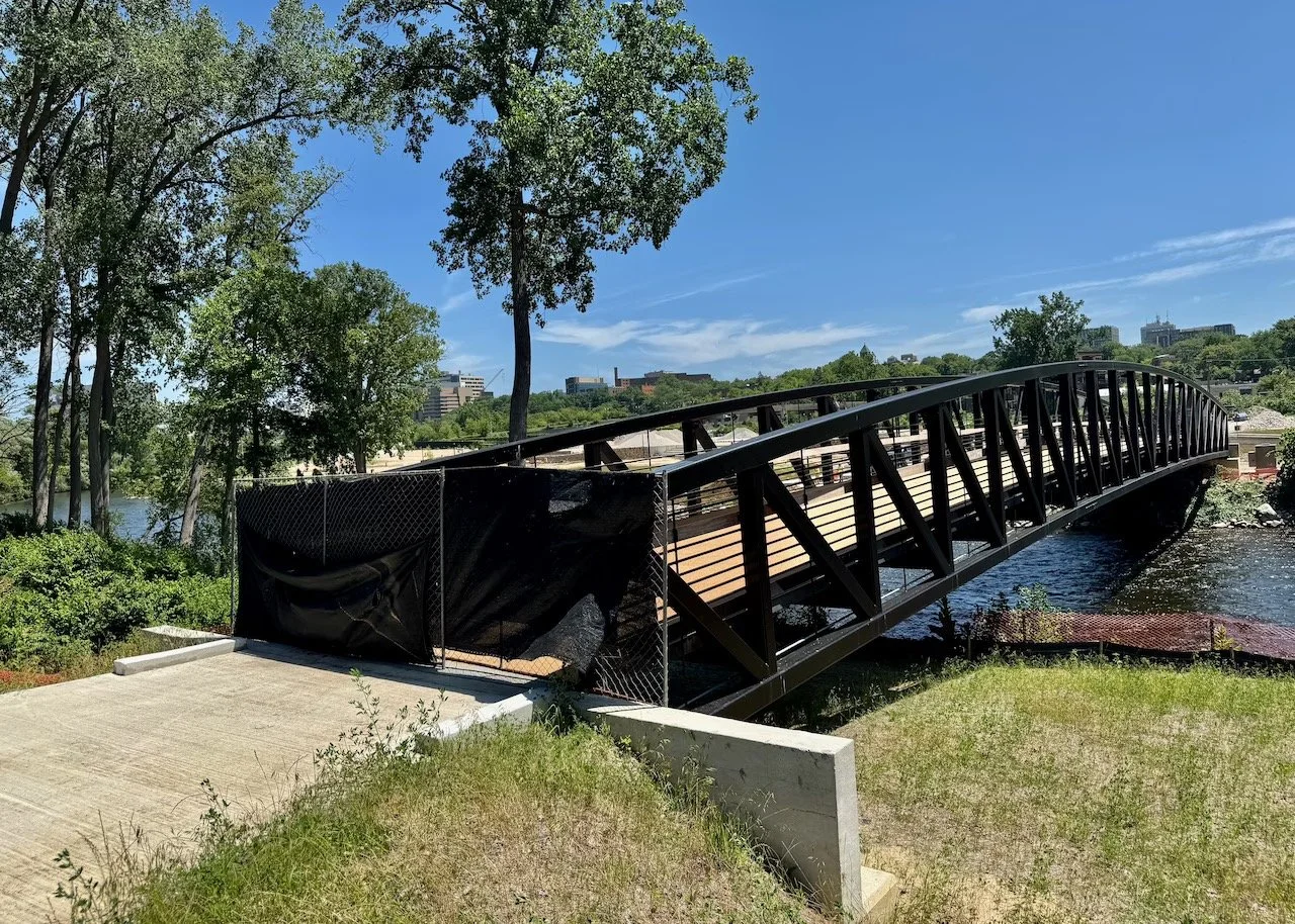
Opened in September 2025, the new Broadway Park West sits right along the river off of Broadway Street. The several-acre park currently features trails, open grassy. areas, and a new pedestrian bridge crossing the river. The new bridge is an important crossing for walkers and bikers to access downtown and Riverside Park. There are development plans for an open pavilion space and mixed-use housing & retail buildings.
New Pathways
Bandemer Park
With the new tunnel under the railroad tracks connecting Bandemer and Barton, there is an opportunity for a new natural path right along the waters edge. The current B2B trail winds through the park, but an additional offshoot path on the riverfront would allow visitors to walk and bike within arms reach of the water. Research suggests spending time alongside water improves happiness, so why not take full advantage of this by creating a wonderful path right along the river from the new tunnel through Bandemer Park?
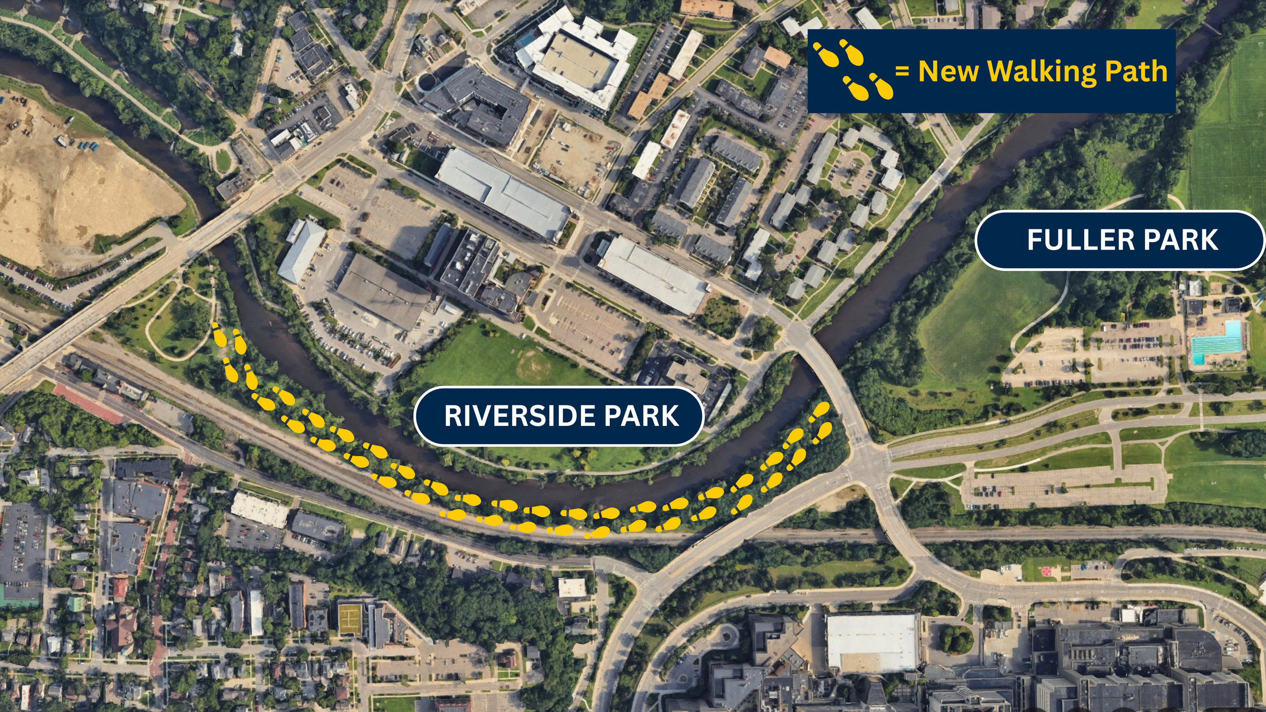
Riverside Park
A new path of the south side of the river, across from Riverside Park, is needed to connect from the dog park near Broadway West Park towards the bridge near Fuller Park. Currently, this stretch is not easily accessible, forcing walkers to cross to the north side of the river before crossing back if they want to reach Fuller Park. As a natural progression of the Broadway West development, a new path to the west would create a seamless, connected walkway on the south side of the river through the busiest section of downtown Ann Arbor.
Restore the Cedar Bend Path to Connect North Campus to Fuller Road
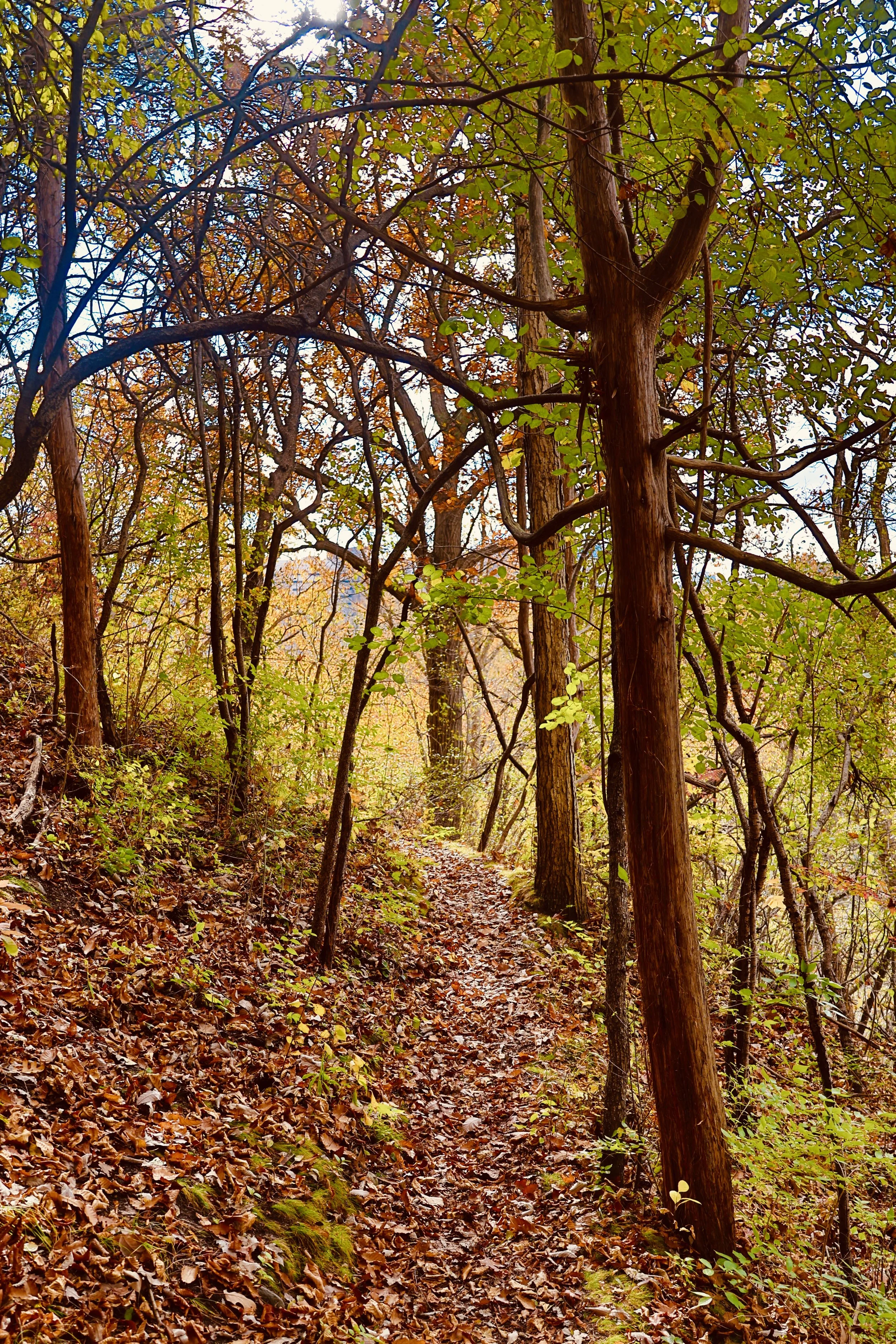
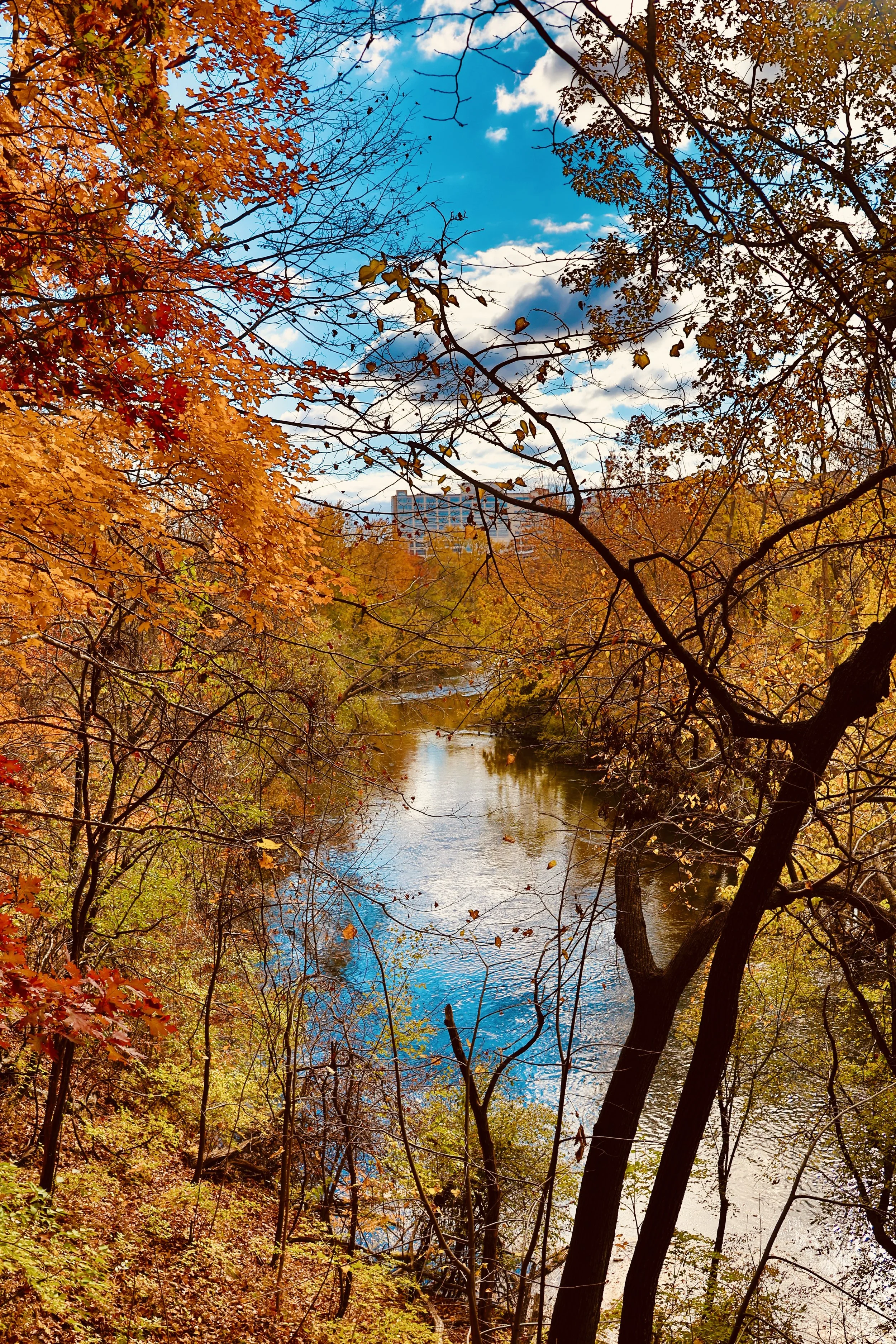
Currently, the established walking route from North Campus to Mitchell Field and beyond is indirect. Re-establishing the historic Cedar Bend path offers a quicker route from Baits II Housing to the hustle and bustle of the heart of Ann Arbor while offering beautiful views of the surrounding forest and the Huron River down below.
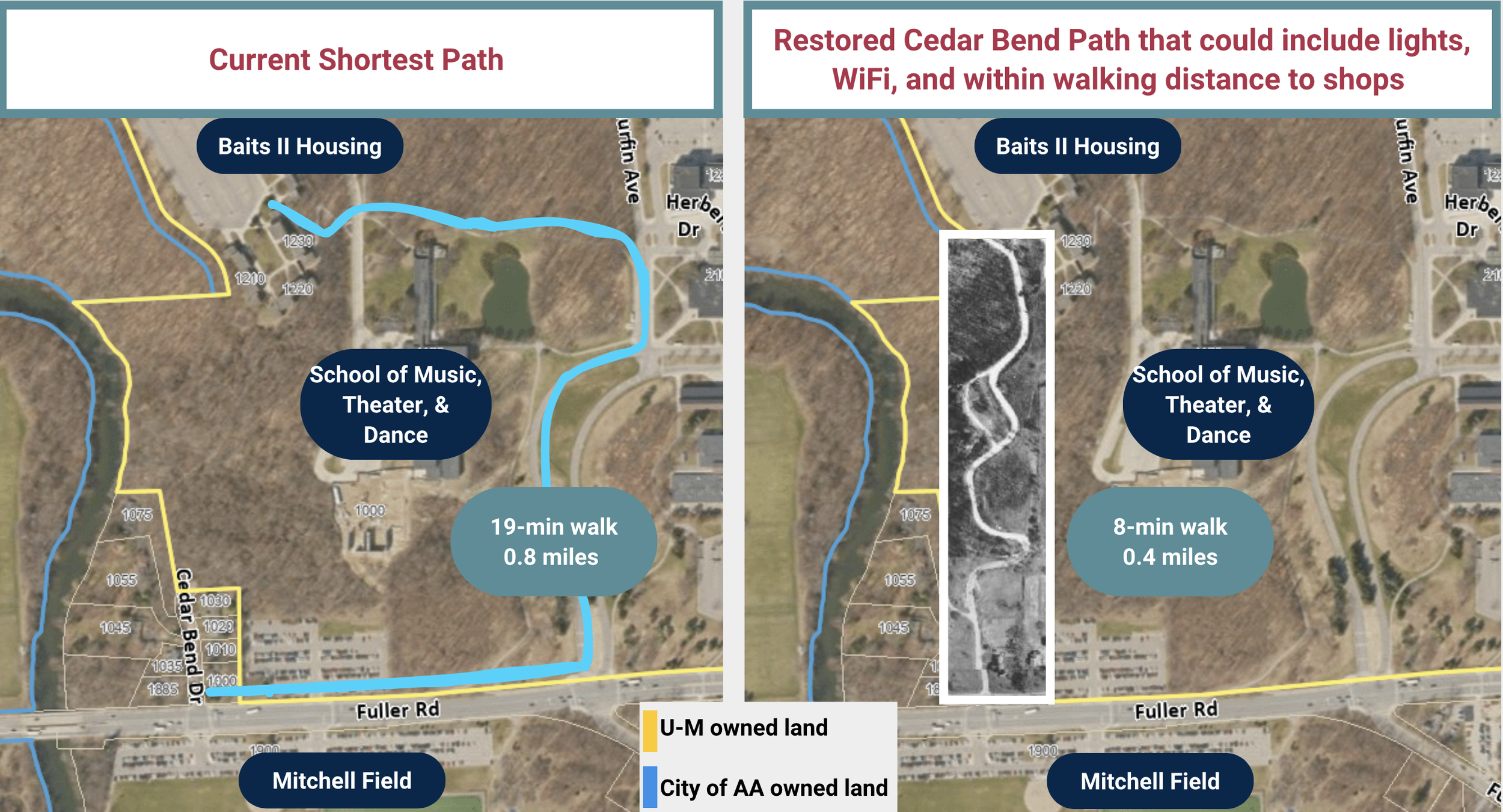
Officially restoring this pathway saves walkers over 10 minutes to get from North Campus to Fuller Road. But, more importantly, it would give more people access to beautiful, elevated views of the River. Cedar Bend as a major pathway should connect to other paths north of the river, allowing quicker foot access to parks on the Northwest side of Fuller, as well as the train station and downtown.
Across the Amtrak tracks south of Mitchell Field sits over 19 acres of university-owned land covered in trees, completely unaccessible to anyone. It is located within a flood zone, making it the perfect place to create additional park land as it is incompatible for development.
The University’s Campus Plan 2050 directly reflects previous EA2 presentations to the Board of Regents and other leadership. Mitchell Field is the connecting point between Central, Medical, and North Campuses, but is currently the most disconnected section of the riverfront.
The Arb Annex
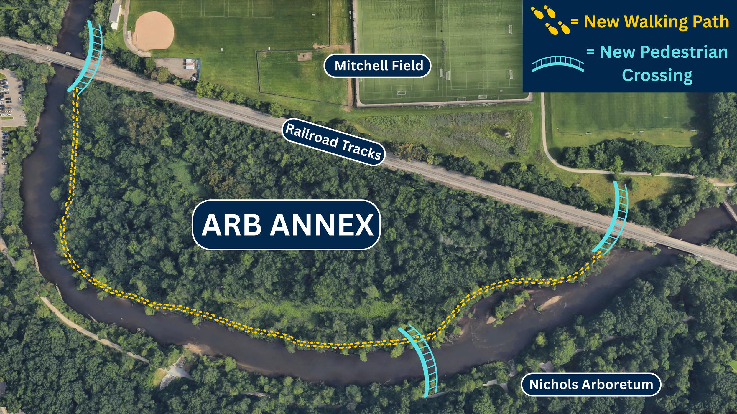
Currently, the Huron River divides North and Medical Campuses from Central Campus and downtown Ann Arbor due to a lack of crossings. Students living on North Campus do not have quick and direct access to the busiest part of Ann Arbor without taking the bus or driving. Michigan Medicine workers face challenges simply walking to work from parking lots along Fuller Road.
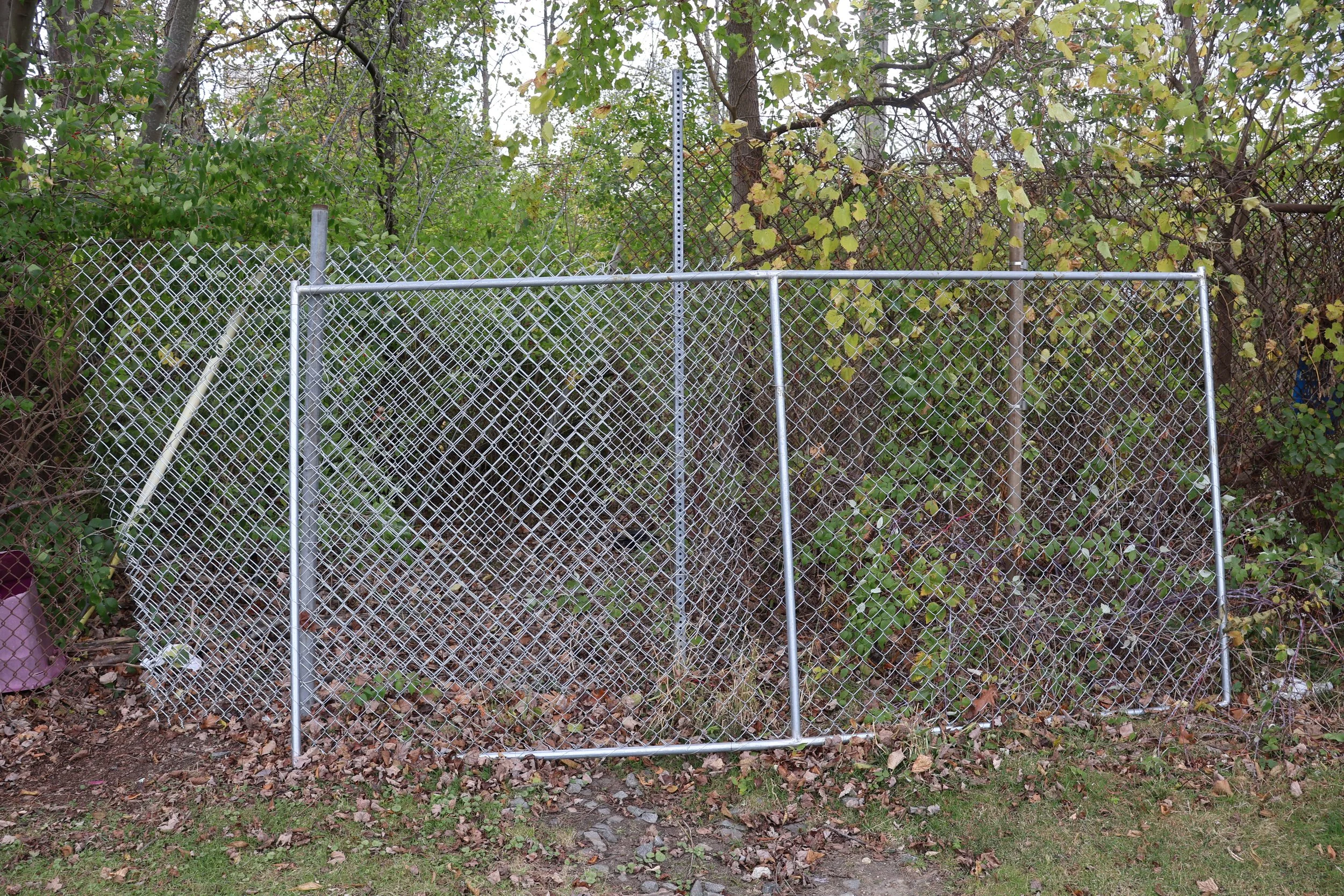
Hospital workers illegally cross the railroad tracks to lessen their walk to and from parking lots on Fuller Road. This is dangerous, especially at night. It is undignified to make these essential workers walk through an unkempt, man made trail and illegally cross railroad tracks simply to get to their jobs. The above picture on the left shows a fence that was recently put up to prevent hospital workers from crossing the railroad tracks, shown in the above photos in the middle and on the right.
A series of new bridges, crossing under the Amtrak tracks from Mitchell Field and across to the hospital, would improve safety and offer a more direct walking or biking route from North Campus to the Medical and Central Campuses and downtown for everyone.


The Arb Annex (shows on the right of the above photo) presents a great opportunity for connect The Arb and Central/Medical Campuses to Mitchell Field, Fuller Road, and North Campus. Currently, Mitchell Field is home to practice fields and intramural sports for the University. Clearing the 19+ currently unaccessible acres of invasives and overgrowth could transform it into another destination, place for practice fields, open space, and more. With crossings over the railroad tracks and the river, and eventual development at Mitchell Field, the Arb Annex is full of untapped potential for the University to capitalize on.